** Days**: 3
**Distance**: 730 Miles
**Hours on road**: 21
**(US) Gallons fuel: **39
San Diego
When the need arose for me to travel to a trade show in San Diego, needless to say I was delighted. No amount of booth duty could stop me from exploring San Diego as best I could.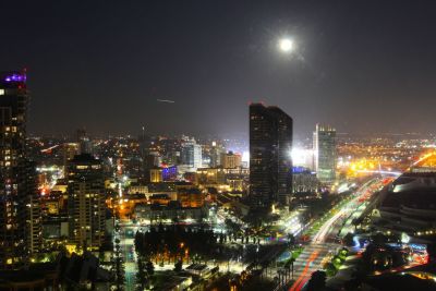 I was incredibly lucky to be staying in the Manchester Grand Hyatt, on the 30th floor with the most incredibly views of the city.
I’m glad to report a 12 hours of solid booth duty on Monday, and a little less Tuesday & Wednesday didn’t dampen my spirits, and after the week’s working was done ([another blog post]), I’d been left with enough of an impression of the city to form an opinion.
San Diego is a fantastically laid back city, clean, with a hopping downtown scene of trendy bars and restaurants. The quantity of craft breweries in the immediate vicinity becomes apparent when looking at restaurants beer menu – my next trip is going to incorporate some brewery tours!
USS Midway is also to be thoroughly recommended – a decommissioned aircraft carrier, which now functions as a museum. The quantity of aircraft on deck makes this double also as an aviation museum.
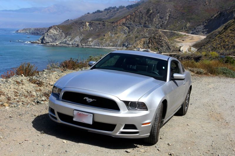 After I’d finished with work, and San Diego, I collected the rental. I’d swung another Ford Mustang as an upgrade from the economy class at the counter – the very same as I’d rented on my last trip. Just 10 miles from the Mexican border, it was time to begin my trip along the Pacific Coast Highway, all 600 miles to San Francisco.
I began my journey on the most densely populated section of the highway between San Diego and LA, stopping along the route only at Laguna Beach to take in the beach, and have a break from driving.
LA & Mid-Coast
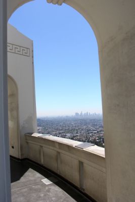
Griffith Observatory – exactly where GTA said it would be
The oft-repeated adage “different strokes for different folks” comes to mind when one attempts to surmise LA – but it’s a city that this framework does not fit.
On approaching and driving around, I fail to see how L.A. could be a city for anybody. It’s dirty, but not in a bohemian sense – it’s just dirty.
There are signs of crime everywhere. What i mistake for heat haze was, of course, smog. Traffic is present day or night.
I decided Venice Beach, an area world famous, was worth a visit. What a dump – think the Costa Del Sol Torremolinos meets NH’s Hampton Beach.
Worst of all, my AirBnB for the night was in an area that would politely be described as “pre-gentrification”. With no mention of this in the listing, I was feeling rather disenfranchised with AirBnB, one of a few disappointments lately.
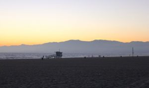
Venice Beach – utter shithole
The only interesting observation I can make about LA is this: Having played many of the Grand Theft Auto series, it’s perfectly possible to orientate L.A. landmarks by means of GTA. The observatory is right by the Hollywood sign, the Hollywood Bowl is closer towards the city, City Hall is near Chinatown, etc.

Scientology HQ, on Hollywood Bvld
The Hollywood Walk of Fame is much longer than I’d expected – it goes on for over a mile, through a far from glamorous neighborhood. In fact, nowhere in LA did I see the glitz & glamour to be found in well-heeled districts of most major U.S. cities. As the centre of all fixation on celebrity culture, I was surprised. Sure, there were some nice, large houses – but in a falsified suburbia amidst urban jungle.
After dismissing LA, a brief canyon hop to the coast, stretching the Mustang’s legs, returned me to Route 1. Malibu county revealed endless seaside houses, along with more beautiful modern architecture and traditional too. It’s also the site of the cover art for one of my favourite albums from back-in-the-day, Incubus’s Morning View. Certainly, the glitz of Malibu is deserved.
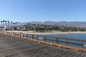
Santa Barbera Pier
Santa Barbara
From Malibu, I continued up the stunning Californian coastline. The PCH still follows a reasonably close path to the pacific, and the ongoing views are to be commended. There’s also a climbing canyon road every five or so miles, each of which are petrol head heaven in their own right. The next stop off the highway was Santa Barbara, first the wharf. It’s a nice walk to the end, with a plethora of tourist traps to occupy the bored – I can attest the Pecan Praline ice cream is good.
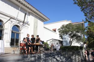 I’d almost left Santa Barbara, assuming there was no more to it – until after glancing at the map, I noticed the downtown area marked the other side of the PCH. Just as well I checked – downtown Santa Barbara is a stunningly beautiful town. It’s full of restaurants that make me think “I want to eat there”; coffee shops “I want to work there”.
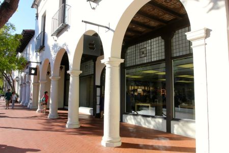
It’s a perfect example of town planning gone right. The parking garages, both surface and multi-story, hide behind a traditional town facade, so much so they’re barely noticed. Also – first 75 minutes free, and cheap thereafter!
Even the chain retail stores blend in with the aesthetic of the town – see both the local Forever 21 and Apple Store for reference: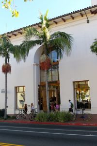
Even the homeless population here look well to do, perhaps a sad reflection that in what is clearly a very wealthy town there is still some poverty.
The only shame for Santa Barbara is the legacy of the PCH, which bisects the main town from the water – small complaint for such an unreasonably pretty town.
After pausing to listen to the sounds of a concert playing at an open night in the town gallery, I dragged myself back to the car – I really wasn’t up for leaving, but my AirBnB host was expecting me.
An hour on the highway along first coastal scenery, then passing vineyards inland saw me in Santa Maria for the night.
It’s at this point, once again; I wish my schedule wasn’t so regimented. My accommodation was vastly improved from the previous night, and the host lovely – but Santa Maria is the most ordinary of towns. It’s an unfair comparison, having just left what was likely the most beautiful Californian town I’d ever seen – but it’s a town affected badly by urban sprawl. The downtown district is nothing more than a busy intersection, and a whole host of strip malls have left the downtown area decimated.
It’s a town without charm, or many redeeming factors. It’s also a town conveniently placed almost halfway between L.A. and SFO. Were it not for the fact I had a reservation, I’d have hopped back in the car and pushed further north – stopping at a cheap motel.
Since this wasn’t an option, I found dinner at a Korean BBQ, in search of a spicy soup. Turns out this place did nothing but All-You-Can-Eat Korean BBQ, cooked at the table – two concepts I’m viciously opposed to.
I trust a chef to judge the portion size appropriate for me (..at least in Europe, I do), and I also trust said chef to cook it for me. The novelty of having raw meat at the same dinner table where I’m about to eat it escapes me – but I’d waited 20 mins for the table, so I went with it.
The food was just the right amount, and perfectly cooked. There goes that theory, then..
Big Sur
A 7am start the next morning put me motoring back towards the coast, away from this dull inland section of the highway. Rejoining the coast at Morro Bay, the scenery gets a little more interesting. The coast along this section is relatively flat. The next interesting detour came in the form of an elephant seal habitat. Apparently the world’s elephant seal population 20 years ago was near-on extinct, but after a successful breeding program, Piedras Blancas Rookery alone has a population of over 17,000 seals.
These guys are like no other seal I’d seen – an average of 16ft long, and 500lbs. Their stench is also noticeable, it’s a sight best encountered on an empty stomach.
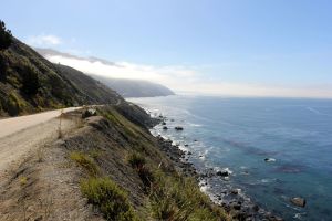
I’ve eluded in the past to West Coast attitudes to coastal access, and I’ll mention it again – because it’s an important fundamental. On the east coast, particularly in Massachusetts, waterfront homeowners protect their beach frontage and access hitherto with a vengeance. The concept of providing public access is so benign to these wealthy blue bloods the mere thought is offensive to them. The rare chance to access the water is provided by state parks, but with an expensive flat-rate parking fee to match – making a quick peak at the various beaches along the coast a non-runner.
In contrast, California’s abundant coastline is accessible to all. Access points are marked from the highway, free parking abounds, and parked cars overflow onto the margin of the highway without over-zealous attendants to enforce arcane parking rules. The coast is an amenity for all to enjoy.
As the highway narrowed down to one lane, the driving becomes a little more interesting too. By 9am however, the road is too busy to be any fun. Something else I hadn’t considered was that driving north on this route of course keeps me on the right hand side of the road at all times (at least, so one would hope). The seaward side is the lane of travel when traveling south. Still, no big deal.
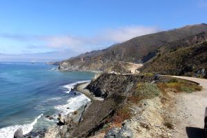 Continuing north, the highway climbs into the Santa Lucia Mountains, affording incredible views. From this elevation, it’s easier to see the migratory path of the humpback whales, too. Less than 1/2 a mile off shore, the distinctive plume of spray can be seen at almost every viewing point. At this point, I was needless to say longing for my telephoto lens – but even with my 17-40mm wide-angle and a bit of digital zoom, it’s possible to see the fin!
 The scenery of the Big Sur region is truly stunning – it rivals not only the rocky coastline of Acadia National Park in Maine, but even the majesty of the Swiss Alps – it’s certainly a sight to behold. Toward the tail end of Big Sur is the “Bixby Canyon Bridge”, of Death Cab for Cutie fame.
Shortly thereafter, the road descends into Monterey, and continues on a flat, dull inland course until after Santa Cruz.
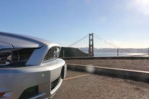
It’s at this point that the highway is once again familiar to me, having done Rt. 1 South from SF to Santa Cruz many times – and blogged about it too. None the less, the route was worth repeating – even to claim to have tracked Route 1 it’s full course from San Diego to the Golden Gate Bridge, my terminal point.
From there, it was through downtown SF and back to the airport.
 Of course, it’s worth giving this journey some scale. Even though it was a long drive, over the course of a leisurely 3 days, this covers only little over half the length of the state. From the Golden Gate Bridge along the North Californian coast to the Oregon border is another 400 miles, or 9 hours of driving. From here, it’s another 339 miles, or 7 hours through Oregon to the Canadian border. I’d covered little over 1/3rd the length of the country.
Route 1, the Pacific Coast Highway is world renowned as the road trip of a lifetime, and it’s certainly scenic. Don’t expect driving of epic proportions – it’s too congested with both cyclists and other drivers to have any fun with. Best take one of the many aforementioned empty canyon roads leading inland – they’re plentiful.
Certainly, this is a trip to be recommended – and one I hope to do again.